On November 3, the All-Ukrainian Agrarian Rada (VAR) public organization, with the support of the US Agrarian and Rural Development Program (USAID), launched an interactive map of the destruction of the agricultural sector in Ukraine, created to demonstrate the real damage caused to the industry by Russian aggression.
As reported on the VAR website, the disclosure of such information can help Ukrainian agricultural producers record the war crimes of the Russians against the Ukrainian agro-industrial complex, which have inflicted over $6 billion in direct losses since the start of the full-scale aggression.
According to the organization, the interactive map posted on the resource agrirecovery.com.ua will become a reliable source of data for the world community, potential investors and government authorities of Ukraine.
During the presentation, the head of the Verkhovna Rada Committee on Finance, Tax and Customs Policy, Daniil Getmantsev, said that the resumption of Ukraine’s agricultural sector after its victory over the Russian Federation should bring it to a higher level, while it is important to record it in detail in order to compensate for the damage.
“We must understand how and how much to collect damages from the aggressor, have a clear legal mechanism that will be acceptable for conducting cases in international courts. So, we urgently need to record the destruction in order to collect the necessary evidence to recover funds from the aggressor after our victory” , – VAR quotes Getmantsev.
According to the organization, the interactive map is designed to document damage and crimes in the interests of the farmers themselves, since the information posted there will be seen by international organizations that make political decisions to support Ukraine. At the same time, it is important that private investment and charitable foundations have access to this information, which will be able to find potential enterprises on an interactive map for further targeted assistance in their restoration.
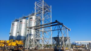
It is specified that the Vkurse Agro project became the technical developer of the map. The map is bilingual: information is presented in Ukrainian and English. The portal provides opportunities for searching and downloading data, photo materials of destruction for each farm, displays information about damaged land plots, land reclamation facilities, crops, etc. A simple algorithm has also been developed for adding new objects, it is possible to use feedback.